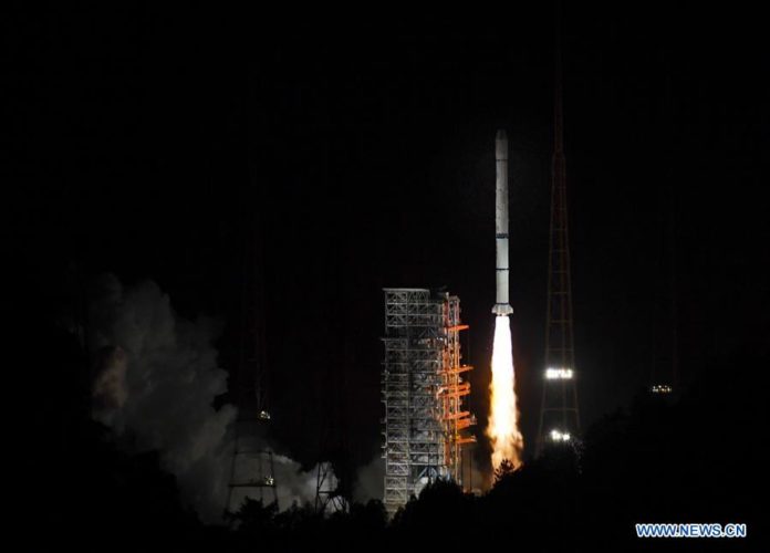
On 5 June 2018, at 9:07 p.m. Beijing time (GMT+8), China launched Fengyun-2H, a meteorological satellite which will be placed in a geosynchronous orbit. The launch took place using the three-stage rocket Long March 3A, from Xichang Satellite Launch Centre in Sichuan Province.
Fengyun-2H will be placed at 79 degrees East, with a launch mass of 1380kg and a design life of 4 years, and will be operated by the China Meteorological Administration (CMA) and the National Remote Sensing Center of China (NRSCC). The satellite will bolster China’s weather monitoring system within its territory, the South China Sea, and the Indian Ocean. According to China, the satellite will be used by Belt and Road Countries, as well as the Asia-Pacific Space Cooperation Organization (APSCO), an intergovernmental initiative led by Beijing.
Fengyun-2H will provide real-time cloud and water vapour images, along with space weather information, to countries across Asia-Pacific (APAC), adding to the data collected by the eight other operational satellites in the Fengyun series.
Its payloads include a Stretched Visible and Infrared Spin Scan Radiometer (S-VISSR) with one visible light and four infrared channels, which will be able to monitor floods and flood-related weather hazards such as typhoons. The satellite also carries a Space Environment Monitor (SEM), and a Solar X-Ray Monitor (SXM).
Fengyun-2H is the eighth and last satellite of the Fengyun-2 series of geosynchronous meteorological satellites, the first of which, Fengyun-2A, was launched in 1997. The Fengyun-2 series will be replaced by Fengyun-4, China’s next-generation geostationary meteorological satellites. The first satellite in the Fengyun series, Fengyun-4A, was launched in 2016. These will complement 3 Fengyun-3 satellites in polar orbit.


