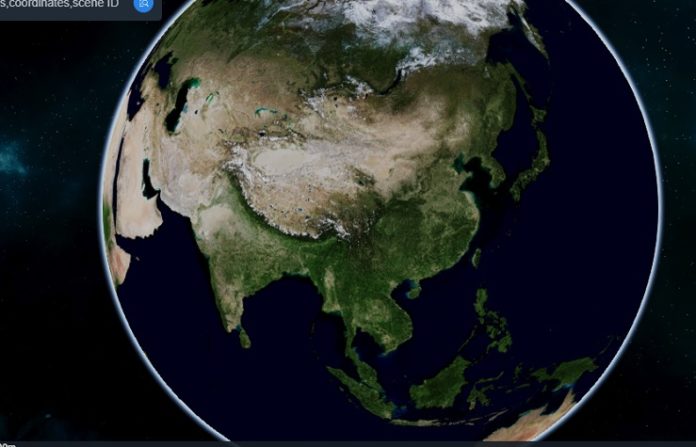
China’s space agency CNSA has launched an international public platform in English, CNSA-GEO, that gives access to its Gaofen-1 and Gaofen-6 satellite imagery, taken by the satellites’ 16m multispectral cameras. These satellites are part of the China High-resolution Earth Observation System (CHEOS), a civilian remote sensing constellation comprising the Gaofen series.
The platform shares three types of data: historical records, daily updated Wide-Field-of-View (WFV) images and global coverage data. It also makes available two PIE (Pixel Information Expert) software developed by Chinese company PIESAT, which can be used to better view and process of WFV data with a swath of 800 km. The platform provides two visual browsing interfaces, Globeview and Swath.
Launched in 2013, Gaofen-1 is a 1080-kg in a 645km Sun Synchronous Orbit (SSO), and is equipped with two 2/8m Panchromatic & Multispectral Scanners (PMS), and four 16m Wide Field of View Multispectral Cameras(WFV).
Like Gaofen-1, Gaofen-6, which has around the same liftoff mass, was launched in 2018, also into a 645km SSO. Gaofen-6 is configured with one 2/8m Panchromatic & Multispectral Scanners (PMS) and one 16m Wide Field of View Multispectral Cameras(WFV), which have the ability of high resolution and wide swath imaging on the same satellite. Gaofen-1 and -6 are meant to be complementary satellites, and together provide global coverage.
Concurrently, China has released 3D-images from Gaofen-7, the newest Gaofen satellite launched in November this year. The 2,400 kg optical satellite is in a 500km SSO, and has a submeter resolution with a 3D mapping technology, but the exact details have not been revealed.


This is very good news!! Thank you for sharing this.