India’s space agency, the Indian Space Research Organisation (ISRO), has developed a software to detect and monitor iceberg calving and deformations.
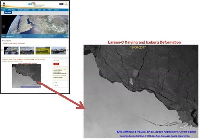
The software was developed specifically to monitor the developments at Larsen C, the fourth largest ice shelf in Antarctica, which has recently garnered attention for its unusually fast rift propagation. Between July 10-12 2017, a 6200 square kilometer chunk of ice broke away from the 50,000 square kilometre ice shelf, in a process known as calving.
Using data from the European Space Agency’s (ESA) Sentinel-1 radar imaging satellite, ISRO’s MATLAB module will be able to automatically read, geocode, speckle filter and subset the data pertaining to the Larsen C area. It will then create an animation of any calving event, which will be automatically modified once new data is received. Along with the MATLAB module, ISRO has also developed another that can automatically download Sentinel-1 data every 12 days, in accordance with Sentinel-1’s cycle.
ISRO is in the process of modifying the module to receive data from its own satellites, SCATSAT-1 and its RISAT series. The software will complement ISRO’s efforts in Antartica, where it has two base stations and conducts expeditions annually, in the organisation’s efforts to study climate change.


