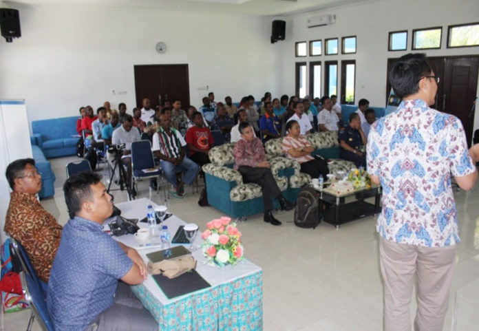
Indonesia’s space agency, LAPAN, has organized a sharing session with local fisherman from the province of Papua, in order to educate them on the use of satellite data for fishing.
Held at LAPAN’s Office of Space and Atmospheric Observation at Biak Island, Papua, the event aimed to share information on one of the agency’s agricultural programs known as Zona Potensi Penangkapan Ikan (ZPPI), or Zones with Fishing Potential.
Head of LAPAN Biak office Marwoto said, “The information used for ZPPI is gathered using remote sensing satellites operated by LAPAN. From the data, we can locate potential fishing areas based on the concentration of marine life in the region.”
He added that the event was a means to share knowledge on space technologies with fishermen, who can then use the information to better their lives.
Such exercises require the collaboration of various local government bodies, as well as different agencies, which have to work together to collect and disseminate data from LAPAN in order to make maximum use of it.
The event was well-received, with participants eager to learn about the practical implications of satellite data. The local community also expressed the hope that more such activities would be organized, so as to raise the awareness of new technologies in the Papuan region.

